
Being able to use well data for multiple uses such as oil and gas exploration, energy storage, geothermal resource identification, and critical minerals exploration is only possible if the data itself is available in a flexible format. Welcome to an interview with Richard Tarver, of the Oklahoma Geological Survey, who describes the powerful new OGS Well Viewer application, which has the potential to transform the way that Oklahoma’s energy data can be viewed and analyzed.

What is your name and affiliation?
Richard Tarver, Oklahoma Geological Survey.
What is your background?
I received my undergraduate and graduate education in Anthropology at the University of Oklahoma with a focus on skeletal biology and archaeology. One of my principle objectives at the OGS is to foster the digital infrastructure of data holdings within the OGS Oklahoma Petroleum Information Center (OPIC) repository and make these materials accessible to the general public. In addition to my managerial duties at the OPIC facility, I am also working to establish a geoarchaeological lithic provenance study to determine the location and distribution of raw source materials used by early Paleoamerican hunter-gatherers to develop their tool industry.
How did you get interested in working with geological data and information?
I joined the Oklahoma Geological Survey (OGS) in 2011 as a Lab/Research Technician III at the OPIC facility, where I currently work as Data and Collections Manager. In this capacity I began working towards virtualizing a lot of the older analog well data that we have housed at the facility. Through various funding opportunities, such as the United States Geological Survey’s (USGS) National Geological and Geophysical Data Preservation Program (NGGDPP), we have been able to digitally preserve a majority of these historical datasets and will now be able to serve this image data up through the well viewer application.
What is your role at the Oklahoma Geological Survey?
I am a Senior Program Coordinator for the OGS and manager of the OPIC facility which serves as the survey’s well data/core and cuttings repository.
What is the new well viewer?
The OGS Well Viewer application is a comprehensive database of Oklahoma’s geoscience and natural resource data that will be free and accessible to the public via a spatially driven, map-based web application. While presently in development, contents of the database will eventually include digitally preserved images of OGS core and well data holdings, publications, and research that will be synthesized with a master record of georeferenced Oklahoma oil and gas wells.
What kind of data does it have? How are some of the data points unique to the OGS?
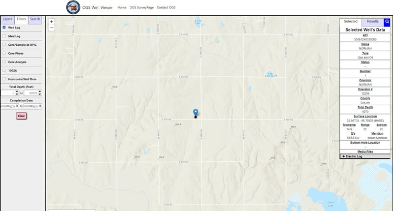
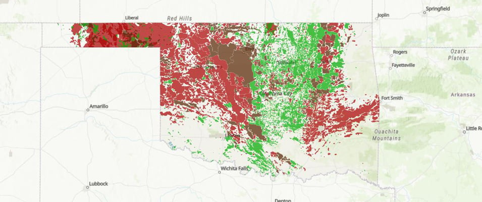
As stakeholders of Oklahoma’s natural resources, the general public will finally have a single online source to access a wealth of information relating to the state’s natural resources, including: oil and gas production data, well logs, completion reports, core and sample data, OGS geology publications, aerial photography, and other data pertaining to the state of Oklahoma’s geology and energy resources. One of the many unique offerings of this application will be over a century’s worth of geological scholarship the OGS has maintained. To start, this wealth of geological data will be tangible in the application’s ability to overlay many of the geological mapping products the OGS has created such as structure maps, oil and gas field maps, hydrologic atlases, hazards and much more as discreet layers within the well viewer.
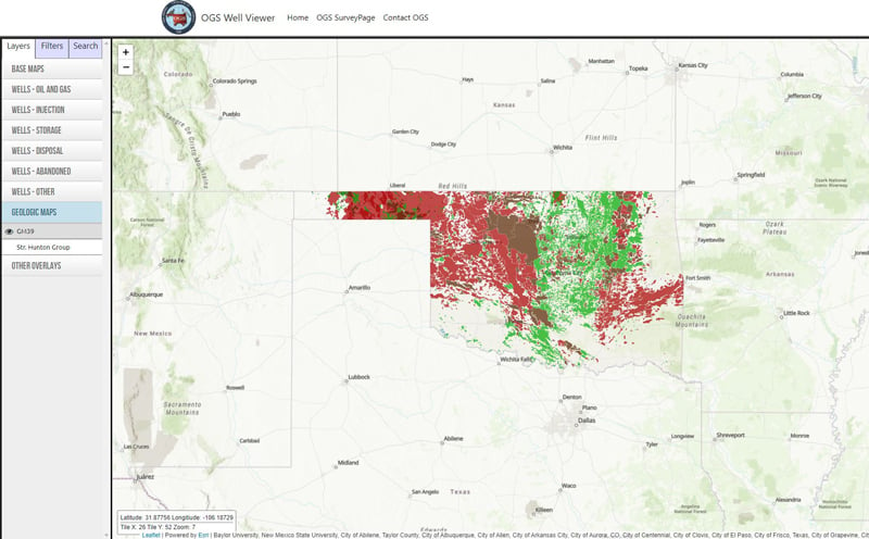
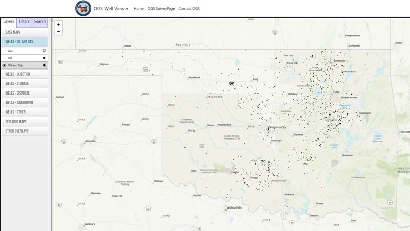
What are some of the different layers in the viewer?
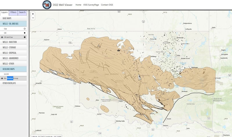
Currently we are able to view various base maps of Oklahoma (STR, aerial photography, topography) various well types (oil, gas, disposal, abandoned, etc.) and then we have a few mapping products from our cartography department such as an oil and gas field map of the state, as well as a structure map of the Hunton group formation as distributed throughout the state.
Do you have any plans for the future? What are some of the potential applications?
The well viewer was envisioned as the initial offering of the OGS to develop a comprehensive application that allows the general public access to the many activities the survey is undertaking. We can easily imagine a future state that represents some of these activities such as seismic monitoring, geological hazards, hydrogeology, critical minerals distribution and more.