
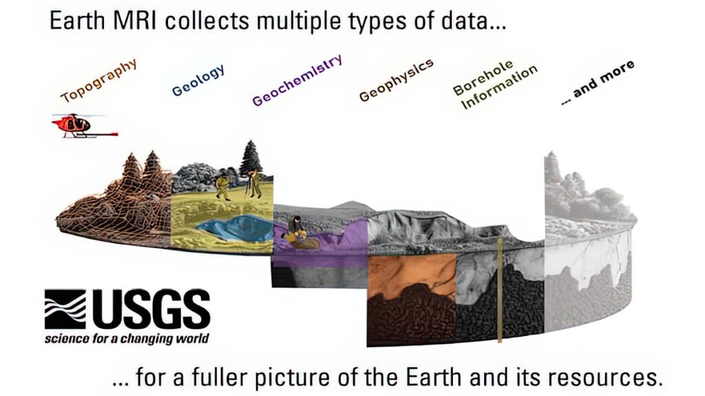
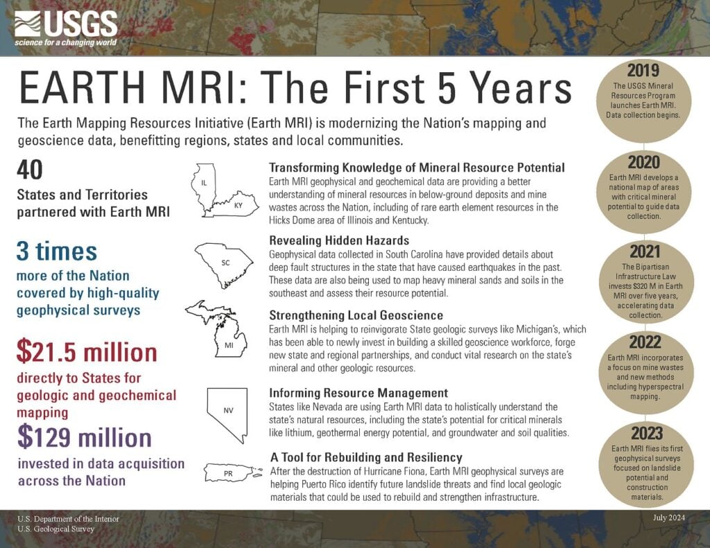
The federal effort to bolster domestic precompetitive geoscience data collection took shape in 2017 with the development of 3DEEP, later renamed Earth MRI in 2019.
Since the advent of the program, the scale of public geoscience data collection has expanded sharply. Before the launch of Earth MRI, only about 7 percent of the United States was covered by high-quality geophysical data. By fiscal year 2025, that figure had reached 26 percent, while Earth MRI had invested $266 million in data acquisition and partnered with 38 states and territories.
 “Precompetitive data” is information that companies can use without giving any one of them an exclusive competitive advantage or requiring them to disclose proprietary information. This shared data can include regional geological maps, airborne geophysical surveys, geochemical datasets, seismic information, topographic data and other information that helps establish a common understanding of the subsurface.
To put it another way, precompetitive data is the concept; Earth MRI is the practice.
Finding and using geoscientific data to improve efficiency and enhance productivity – and, ultimately to strengthen supply chains, economic resilience, and national security – has always faced a number of obstacles, not the least of which are access and cost. Non-uniform governance across states, inconsistent data standards, variable funding, and tensions between proprietary protection and public release often impede data collection and exploration.
Many leaders in industry, government, and academia agree that sharing precompetitive geoscience data can help alleviate many of those hurdles.
An Under-explored America
Recently, the Committee on Earth Resources, part of the National Academies of Sciences, Engineering, and Medicine, hosted a series of panel discussions: “Precompetitive Geoscience Data in the United States: Benefits, Barriers, and Opportunities for Progress,” to explore the benefits associated with precompetitive data, the unique challenges to the United States, as well as the opportunities to advance data sharing.
The purpose of the meeting was threefold:




- Discuss how precompetitive geoscience data can advance critical mineral exploration and strengthen domestic supply chains
- Explore how data sharing can improve the understanding of the complexities of the subsurface
- Identify opportunities for such sharing
Erin Campbell, Alaska’s state geologist and one of the speakers, said that there has historically been a split between government and industry.
“Those who worked in academia and government were primarily interested in publicly available data, with industry sometimes preferring to keep their data confidential,” she said.
This made sense, she explained, as industry funded the work and was trying to maintain a competitive advantage. But then it became clear that the United States was falling behind other countries in resource development.
According to the U.S. Geological Survey, this was due to four main factors:
- Many of the federal mapping programs, in part due to environmental concerns, wound down in the 1980s, and government mapping efforts failed to keep up with the latest technology.
- Colleges and universities cut back many of the core-related geology courses and fieldwork.
- Schools saw a decrease in geoscience students.
- There was a reliance on old data.
Because state geologists use federal funds to map the locations of mineral deposits and energy sources, as well as study wildfires, water resources, and hazards, they, too, were hampered by the above obstacles. Private industry mapped small areas of particular interest, but, as Campbell pointed out, was reluctant to share information with competitors.
Simon Jowitt, director of the Nevada Bureau of Mines, said this disconnect created a big problem.
“Serious mineral exploration has happened in the U.S. for maybe 200 years or so. So where is the U.S. under-explored?”
He answered his own question:
“Probably most of the country.”
He said that in his home state, Nevada, around 50 percent of it is under-explored.”
Tenzing Joshi of KoBold Metals, a company that develops and applies machine-learning technologies to accelerate critical mineral exploration and discovery, said that his company exists because the “pipeline of new deposits that the world needs is far too thin.”
He said the bottleneck is discovery and that it takes eight times more in exploration dollars to make a discovery than it did 30 years ago.
“And the reason for that is two sides of the same coin. A lot of the easy deposits have been found,” he said.
An Interstate Data Highway
Earth MRI is not the only source of precompetitive data, but it represents a form of shared infrastructure – an “interstate highway system” of sorts for geological data, rather than a series of state and county roads.
It is a map for companies, not directions.
Artificial intelligence could further increase the value of this shared data by rapidly searching, integrating, and analyzing massive public datasets. In doing so, it can help accelerate interpretation, which, in turn, will help build regional subsurface models, which, in turn, will allow industry to work from a more complete understanding of the geology while keeping proprietary information confidential.
One example is GeoMap-Agent, an AI tool designed to understand geographic information, including maps and spatial data. By combining LLMs with specialized spatial tools, this agent can rapidly automate tasks such as data retrieval, map styling, and complex spatial analysis.
Government will provide the common geological data. Companies can then decide what they want to do with it.
“I think artificial intelligence is really good,” said David Zhen Yin of Stanford Mineral-X, who was also a presenter, “but it relies fundamentally on having good, high-quality observations. It is no substitute for explanation. That’s where we as geoscientists come in.”