

The Datapages Archives offers more than a thousand articles resulting from a keyword search “Woodford Shale.” Additionally, just searching for related papers by title yields the following:
- 200 articles with “Arkoma Basin”
- 400 with “Anadarko Basin”
- 35 with “Ardmore Basin”
- 21 with “SCOOP and STACK”
Arkoma Basin
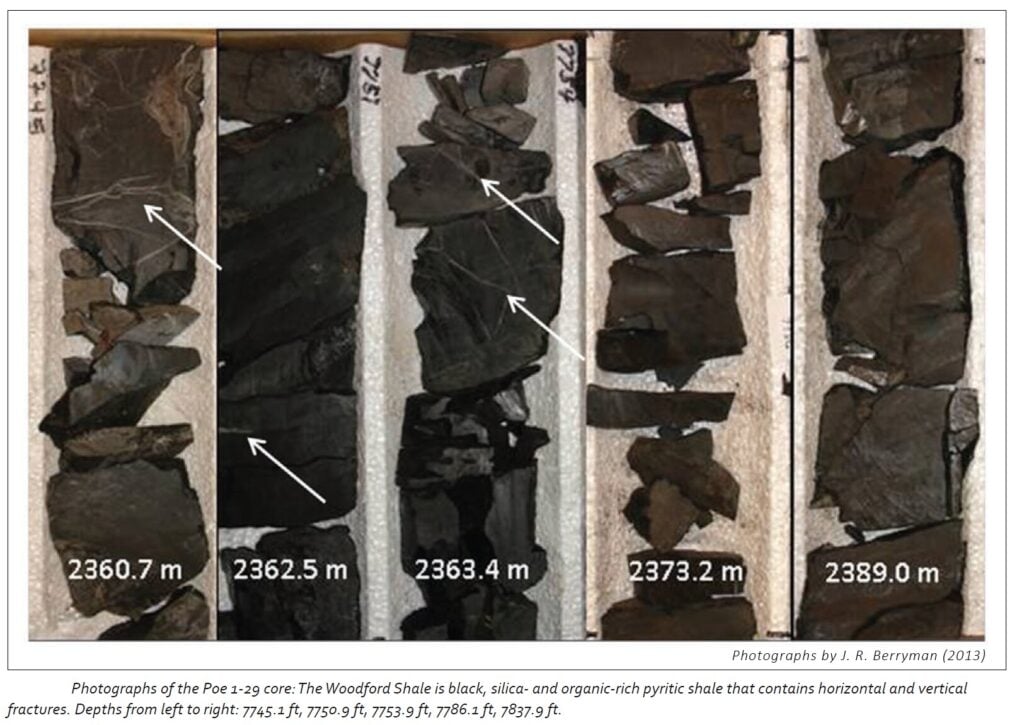
In the Arkoma Basin, the Woodford is brittle and highly fractured with fracture-filling calcite and silica-rich beds. The basin has a generalized bed dip in the northwest-southeast orientation. The Arkoma is structurally complex due to Late Precambrian to Early Cambrian rifting of the Southern Oklahoma Aulacogen and then Carboniferous period deformation as the Ouachita foldbelt was deformed; thus, horizontal development is limited by the complex fault regimes. Three primary targets for development are the Caney Shale, Mayes Shale, and Woodford Shale. The Woodford is in the wet or dry gas phase windows of maturity, in the Arkoma, with wet gas in the western part of the basin and the dry gas phase in the east.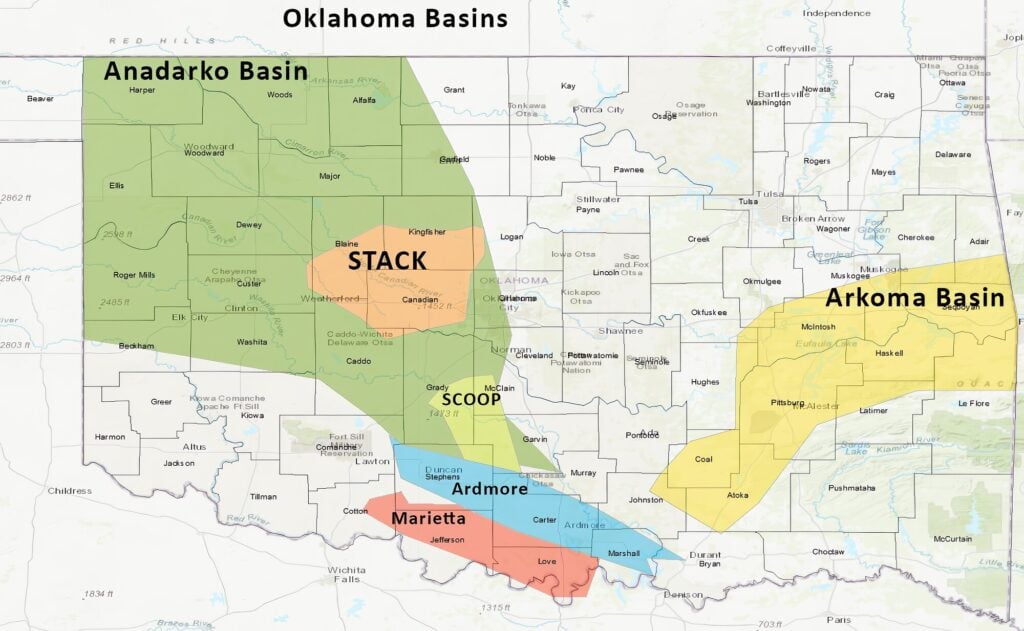
Anadarko Basin
The Woodford Shale is the dominant source rock in the Anadarko Basin. Fritz and Mitchell (2021) have demonstrated that the Anadarko meets all the requirements to be a “super basin” with “cumulative production close to 50 billion barrels of oil-equivalent and the potential to produce another 50 billion BOE.” The Woodford Shale has generated and expelled more than 300 billion BOE. The Anadarko plays of the SCOOP and STACK are in the early stage of well density (spacing / infilling) production drilling.
- The South-Central Oklahoma Oil Province (SCOOP) play is located in Garvin, Grady, McClain, and Stephens counties. The play primarily targets the Woodford Formation as well as the Springer Group, the Caney Shale, and Sycamore Formation. The play offers competitive opportunities at a lower entry cost than other areas.
- The Sooner Trend Anadarko Basin, Canadian, and Kingfisher Counties (STACK) play is divided into two areas: STACK West and STACK East. STACK West is in Custer, Dewey, Major, Woods, and Woodward counties. STACK East is in Blaine, Canadian, Garfield, and Kingfisher counties. The main targets are the Meramec, the Osage, and the Woodford, which are hydrocarbon saturated and thermally mature.

Ardmore Basin
The Ardmore Basin is in the south-central part of the state. The basin is elongated from the northwest to the southeast, approximately 100 miles long. The basin is approximately 20 miles wide from the southeast to the northeast. Here, the Woodford Shale is a highly productive source rock with total organic carbon ranging from 0.07-15.6 weight percent, in an immature to early maturity window. Hundreds of wells drilled in this basin prove the oil and gas potential of the Woodford Shale. Clearly, opportunities still exist for future development.