A drone-generated map can translate to a million-dollar cost saving, or new fields or offsets with millions of dollars of new revenue. It's a great ROI, and the potential is just now beginning to be explored. For example, high-definition digital images can, depending on the sensors used, result in maps that show previously undetected structures and also surface geochemical anomalies, such as oil and gas micro-seeps or haloes. Welcome to an interview with Jason Pedersen, Space City Drones (
https://www.spacecitydrones.com/), who discusses the new equipment, techniques, and opportunities with drones.
What is your name and your history with drones?
My name is Jason Pedersen and I am the owner and operator of Space City Drones, a drone reseller based out of Heber City, Utah. My passion for drones began as a casual interest, but it didn't take long for it to become a big part of my life, both as an incredibly fun hobby and also as a real asset to my businesses and a new branch to my artwork.
When and how how did you become interested in drones?
As a technology enthusiast and someone that loves to play with the latest and greatest, my wife surprised me with a drone for my birthday one year, just as a casual toy. I quickly became fascinated by the potential for photography and videography, and found the challenge of mastering the flight skills to be something I couldn't get enough of. Around that same time, an opportunity to enter into the commercial drone re-sale industry came my way, and I saw a way to combine my passion for the hobby with my entrepreneurial skills, and it was a no-brainer for me. Since then, the research and experience that I've needed in order to grow my business and become an industry expert has led to this industry becoming the one that, in all my years of business management and entrepreneurial ventures, is my absolute most consuming passion. The combination of its potential for learning new skills, expanding art, utilizing technology, and constant growth and development is what feeds the soul of an artist, an entrepreneur, a technology enthusiast, a scientist, and a geek like me.
What are some of the areas of most dramatic growth in drone uses?
Consumer drone use is by far the area that's experienced the most dramatic growth in the past year, which is partly due to the affordability of newly available drones for hobby use, and also due to the fact that the consumer drone industry is the newest portion of the market. Government use, agricultural use, and military use of drones have been, historically, the most widely-used application of drone functionality. As the consumer market has expanded in popularity, the number of possible uses for drones continues to grow as well.
It's not just big business that uses drones anymore, either. We know that drones have been used for land surveying, monitoring and inspecting field equipment safely, cutting costs and resources needed for aerial management and surveillance, and more, but now even small businesses use drones frequently for aerial photography and videography, security surveillance, advertising, small-scale transport, and more.
What are some of the key things one should know about the regulatory environment?
First and most important, it's important to know that each of the things I'm about to list DO have potential exceptions and waiver possibilities. But, in general:
The FAA regulates no flight above 400 ft, within 5 miles of an airport, after sunset, and the UAV must be in your sight at all times.
The FAA Aeronautical Knowledge exam will allow you to apply for waivers, obtain insurance, and to use the drone for commerical purposes. Without this certification, a drone-user is limited to recreational use only.
To put together a successful drone venture, what kinds of team members do you need? How can an individual or a small business that focuses on natural resources development and geographical information get started? How best can they team up?
It can really depend on the scale in which you need to use them--
For a small-scale operation, often one man can shoulder all of the basic responsbilities.
For a typical team in a medium-sized organization or company, your ideal team would consist of:
At least registered or certified pilot to fly the UAV, and one to maneuver the cameras. However, you'd be adequately covered with two certified FAA Commercial UAV Operators. (You could manage with one, but two covers you more completely.)
Technician — available to repair and troubleshoot both the drones themselves, and the cameras and other equipment necessary for the drone to meet the needs of your operation.
Industry expert for interpretation or artistic direction — available to guide and direct the flight and perspective of the drone for artistic purposes, or available to interpret the data and visual nuances that the drone captures during its flight.
What kinds of drones are best to use and how much do they cost?
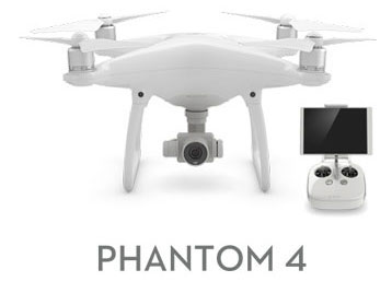
For professional industries in need of high-quality and precision such as geology, the DJI Inspire quadcopter, or the Spreading Wings octocopter, essentially any high-quality, professional-grade drone would be an optimal choice. These drones typically range from $1900 as a base model, up to around $4500+ for a customized drone with close-range zoom camera capability, thermal camera capability, multiple camera compatibility, and more.
Most base-model drones do not come with close-range zoom capability, which means if your drone-capability needs involve high-quality, close-range imaging, you'll need to be prepared to customize your drone fleet to a certain degree.
What do you see as the best opportunities in the medium-term?
From a natural-resources and geology perspective, the best opportunities in the near future are going to be in the realm of 3-D mapping. With the increasing capability of volumetric measuring and 3-D viewpoint, we can get real-time data on the efficiency of an operation, from pipe flow, to inventory measurement, and more — all just by flying drones over it with the right equipment.
Outside of geology and natural resources, the best opportunities in the near future for drone application and business will be in video production, from small-scale operations like real-estate marketing, to large-scale operations like the film and production industry. The real-estate angle is one that anyone can get into with a little bit of education and certification, so it's more accessible but less potential for huge revenue. The film and production industry is much harder to get into, but is likely to make a few people a whole lot of money in the coming years.
Meet Jason Pedersen and other presenters at the AAPG GTW, New Opportunities with Drones: New Needs, FAA Rule Changes, New Technologies, December 1-2, Houston, TX
Want to learn about how to interpret drone-derived data?
Sign up for "Working with Drone Data 101"