You may not be aware that there was a super-Greenhouse environment during the Cretaceous, and that there were super-storms associated with it, and that analyzing the sediments deposited during that time can provide insight into the potential warming of climates, and also the cross-shelf transport of sediments. That is just one of many fascinating new areas of research that looks at data through new lenses, and with new analytical techniques. Welcome to an interview with Lesli J. Wood, Weimer Distinguished Chair and Professor in Sedimentary and Petroleum Geology, Colorado School of Mines.
What is your name and your research focus?
My name is Lesli J. Wood and my research focus is seismic geomorphology, planetary geomorphology, ancient landscapes and climates and exploration and development of extractive resources.
Where are the reservoirs that you're working on?
All over the world. The basins of the Rocky Mountains; San Juan, Piceance, Denver, Powder River basins, New Zealand, northwest shelf of Australia, deepwater fold and thrust belts of the Caribbean, Gulf of Mexico and southeast Asia. I have also worked in basins in offshore and onshore India, Morocco, North Sea and a few other places.
Please describe your recent research interests and focus.
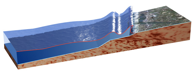
Tsunami approaching Coast
My recent science interests are in integrated studies of ancient landscapes and seascapes using seismic data from the northwest shelf of Australia. There we worked with companies to look at very high net-gross deepwater deposits and to identify the processes (ie., current- and gravity-driven) that result in rift basin fills. I have been involved in such types of work in margins around the world for nearly 30 years. I have also recently become very interested in mega-storms associated with the super-Greenhouse environments of the Cretaceous as a window into the nature of storms associated with potential warming of climates. The record of these mega-storms is contained in the sediments that were deposited along the margins of the Cretaceous oceans. The storms, I believe, play a role in the cross-shelf transport of clastic sediments into deep shelf and deep plain depo-sites. Storms originating in the open, proto-Gulf likely moved up into the epicontinental seaway and strengthened beyond anything we are used to occurring along the shorelines today. A view of possibly things to come. A third science focus is in the nature of submarine mass failures and the role that they play in working hydrocarbon plays, hydrate formation and failure and as a driver for seafloor and tsunamigenic hazards.
My other ongoing interest is in how to build effective integrated teams, how engineers and scientists communicate (or don't!) and how we communicate our science to non-specialists in our field and in the public. This is a huge issue of how we ask appropriate questions and how to convey the answers.
How do new technologies, sedimentology, and reservoir characterization come together in deepwater environments?
There is an abundance of new or re-discovered tools for collecting more and more detailed data in sedimentary systems. Zircon analysis age dating techniques, multi-volume and sub-salt imaging seismic techniques, clay-analysis techniques, drones and LiDAR imaging of outcrops that were once accessible only by mountain goats or birds; these tools provide MORE data, but is it the data we need to address key uncertainties, and can we understand how these data relate to OUR particular setting. Sedimentology is a PIECE of reservoir characterization. If we focus on the sedimentology of deepwater systems, we KNOW that the sedimentology is more complex than we are able to directly image in plays around the world. The use of well-constrained, and contextualized analogs of deepwater reservoirs is so critical for de-risking, exploring for and developing deepwater plays. We host an analogs database called SAND here at CSM, and it is critical that such data be contextualized with an accompanying knowledge database of how and where the data were collected, and how the data can be best used. Such analogs for deposits and processes in deepwater environments, when placed in a context that is easily derived from seismic and well log data, allow us to choose analogs from modern and ancient deepwater settings that are similar to our own plays.
Being a physical modeler from way back, I appreciate the advances in our ability to model deepwater processes (ie., gravity and current driven flow). Advances in computing enable data collection on modelled, modern and ancient deposits that were unrealized 20 years ago. Modelling provides a controlled sedimentologic and process environment where we can test ideas in processes and sedimentologic response that might lead to new plays and new understanding of the architecture of known fields. Modelling has been used to great effect in understanding the processes that result in mass sediment failures, cross shelf transport of sands into deep water, and the interaction of gravity sedimentation and complex seafloor topography.
Improved resolution in seismic and new attribute techniques must be coupled with a broad understanding of what depositional systems; geomorphology and sedimentology, look like if we are to recognize how to use our new found data to impact our interpretations and understand what we are looking at. Computers now enable extraction of attributes at a spatial scale that enable us to map entire margin seascapes and landscapes. Likewise, we can now create more and more temporally detailed and spatially extensive models of deepwater systems, and create them faster, as is the demand from management.
What are some of the new tools or techniques that are being used?
Analog databases are being recognized as invaluable to individuals trying to de-risk and build reservoir models in deepwater systems where often precious few detailed datapoints exist.
Zircon dating has found a renewed fan base in Source-2-Sink workers. This technique offers an opportunity to build a new stratigraphy if applied to basins worldwide. Although similar to ammonite or foram biostratigraphy, zircons differ in that they offer opportunity to date the sands instead of just dating the shales. This knowledge could add significant detail to our understanding of stratigraphic sections that were once based solely on the age of the mudstones.
New techniques in mudstone analysis using near infrared spectrometry in outcrops to define mudstone mineralogic differences for various deepwater depositional elements may help to solve some questions about sealing versus non-sealing deepwater facies.
Seismic geomorphology of deepwater systems and elements tied to quantitative character using logs and core can help us define the spatial relationships, size and possibly internal character of all the elements (mass failures, channel/levee complexes, overbank deposits, faults, seeps, etc.) that compose the character of reservoir systems in deep water.